We are REALLY lucky to have such a wonderful place so close to home!
They have various trails inside the center.
Most average 30 minutes or so. You can do one or several to make a day of it.
Stop at the visitor center or the rack at the entrance guard station to get a brochure and trail map.
They also have the rugged 13 mile millennium loop trail. Be sure to register at the visitor center before tackling the millennium trail.
Late summer 2002 they opened a new creekside hiking & mountain biking
trail across the road.
This trail is "packed" gravel. Not my cup of tea for biking but it will
get better with age. To reach this new trail exit Bernheim back on 245 and
turn right towards Bardstown - away from I65.
Go short distance, maybe 3/4 mile to the Jim Beam distillery
on your left.
Turn into Jim Beam and immediately see the old Clermont post office
on the left. Look right, across from the post office and see a new
gravel parking lot. This is the trail head for this linear (out and back)
3 1/2 mile trail. The trail follows the creek and RR tracks parallel to 245
for 3 1/2 miles. 2 brand new bridges cross the creek. Walk it out and back
and get a 7 mile entry in your hiking journal! We hiked it one winter's
day with clear sky, 33 degrees and an inch of snow cover. It was LOVELY!!
Directions:
30 minutes South of Louisville
I65 South to state road 245 & turn left. Look for
their entrance on your right about a half mile down 245
(to reach the new creekside 4 mile mountain biking, hiking trail continue
on 245 past Bernheim for half mile or so to Jim Beam distillery on the left.)
Only open for public access on Sundays from 1 to 5 PM beginning April 7 through June 30 and September 1 through November 24.
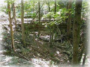
They have an old road that runs from the entrance all the way to the very back end where it ends at the RR tracks. And they have a loop trail through the woods. It's not too long. I can't remember exactly but I think you could walk the loop in 1/2 hour if you really hurried but it's too pretty to hurry. The road is probably another 1/2 mile or a bit more if you start clear out at the entrance. Road isn't a good description.... it's a tree lined lane. There's something about trees along a dirt and gravel road that makes me want to see where it goes, even if I KNOW where it goes!
Here is a web link to the Blackacre Foundation.
Remember it's open only on Sunday afternoons from 1-5 in the Spring and Fall. You can tour the old farm house as well during that time. They have driving directions on their web site. It's easy to find and really under used by the public. We've been there when we were the only people there except for the volunteers who open the house and answer questions on Sundays. My advice is to wait for a cool Sunday and go visit!
Directions:Take the Gene Snyder Freeway to Taylorsville Road hwy 155
Turn West toward Jeffersontown - away from Taylorsville.
Go about 1 mile to BP gas station at Tucker Station RD.
Turn right on Tucker Station and go .3 mile. (that's 3 TENTHS)
Look for the Blackacre sign and gravel drive on the left.
Take the right hand drive, the left one leads to the community vegetable gardens.
3200 Tucker Station Road
These two trails both start from the same parking lot. They are located on Fort Knox property and may be closed on occasion for training exercises or during deer season. The parking lot is located off Dixie highway (31W) about 3/4 mile south of Westpoint. (On the way to Ft. Knox)
The Bridges to the Past trail is paved and a gentle grade. It makes a nice walk of about 1 mile to the end. If you are lucky you can find brochures in the kiosk just past the RR trestle. The "trail" is a paved road that is laid on top of the old Louisville - Nashville turnpike. The bridges are really just stone archways under the road and you can walk right over them almost without noticing. The historic roadbed and was hand built before the civil war. Some of the bridges were repaired by German POWs during WWII.
Features some great woods and typical Kentucky scenery.
Very easy trail, strollers and wheelchairs should be fine.
No bicycles allowed - darn!
If you stand in the parking lot with the RR trestle on your left and look to your right you should see the kiosk with brochures (if you're lucky!) and the trail head for the Tioga falls trail. This is a typical in the hills and woods type trail. Sturdy hiking boots are recommended because the trail often has roots and rocks hidden under the leaf litter. You can really mess up an ankle if you're not careful and wearing the right footwear.
This 2 mile loop trail takes you up and across the RR tracks then around an old
hand laid roadbed that used to lead to the now completely gone Tioga Falls
"resort" hotel. You can stop at the falls and if you look closely you will
see the remains of the dam that used to block the water and form a swimming hole
for the guests.
Follow the trail on around the lower part and see a springhouse and other foundations.
Wind up under the second RR trestle and you're almost back.
Note: When you reach the RR trestle stop and look up for a moment. This trestle has all "small" steel in it. It's like a giant erector set! Men without benefit of large cranes or machines would have built this trestle. The steel had to be small so a crew of men could carry and place each piece. Then the pieces were riveted together with thousands of rivets. Imagine the men climbing around without hard hats or safety belts. The pitcher on the ground would take red-hot rivets out of the forge and toss them up to the catcher who would catch them in a bucket. He'd grab them with tongs and place them in a hole where the riveter would hammer it round with his steam hammer. Imagine the smell of the coal smoke, the sweating men and the machine-gun sound of the steam hammer rat-tat-tat. That plain old RR trestle is really something when you use a little imagination!
You should wear your hiking boots and bring a water bottle for the falls trail.
Directions:Gene Snyder freeway West to Fort Knox exit at 31W South
Go south on Dixie (31W) past the stop light
at Westpoint.
Continue for about 3/4 mile to the flashing yellow
light and turn left.
Follow this road straight into the parking lot.
Note, take a restroom break before you get here and bring a cooler
with some water or soft drinks. There are no facilities.
You can go just 9 miles past Otter Creek park to Brandenburg. They have a great little river edge park with shade trees and picnic tables and a new sidewalk along the river bluff. AND don't miss the 2 1/4 mile paved trail to buttermilk falls. The trail head is on the right as you are driving through the park.
It's only about 1/2 mile from the trail head to the falls but the paved road goes on almost 2 more miles. It's paved but it's closed to traffic so there are no cars. It's very peaceful and lots of shade. Gentle grades. Folks regularly visit with strollers but you can make a good walk if you push yourself a little bit.
It's a one way trail so you go out and back the same way.
Total round trip from end to end and back, 4 1/2 miles.
If you just want to see the falls it's an easy one mile round trip BUT
you will be missing all that great peace and quiet that you will experience
if you continue on to the end.
12501 Harmony Landing Rd, Goshen, KY 40026
(502) 228-4362,
Right next door to the Mahan-Oldham County Public Library but don't let that fool you. This is a country setting!
The Creasey Mahan nature preserve is an old farm that was donated to the nature preserve years ago. They have some open pasture and some nice woods as well. There is a casual mowed (ie, grass) trail that loops through the woods. There are some open areas with shade trees where you can toss a blanket on the ground and have a picnic and still feel the breeze. There is also a small play ground in one corner if you have children or grand-kids of the swing and slide age.
There are soccer fields so it might get noisy on weekends or evenings, but we were there on a Tuesday mid day and had the entire place to ourselves.
Directions:
From Louisville take the Gene Snyder East and then North to the end at highway 42.
Turn right on 42 to Goshen.
Turn left onto 1793 and go about a mile or so.
Look on your right for Harmony Landing road and the Library.
The preserve is right next to the Library.
Speaking of Dixie hwy. don't forget Otter Creek park! Really great hiking trails and if you go during the week, there are few people there.
It's open to mountain bikers so bring your bike or your hiking shoes.
For such a great park so close to Louisville it's practically deserted on week days after school starts. It gets a bit more crowded on weekends but is still good if that's the only time you can go. They have several miles of loop trails. Get a trail brochure from the nature center. There are also restrooms in the nature center.
Directions:Get driving directions from their web site or just take the Snyder
freeway west to 31W south towards Fort Knox.
Go South on Dixie hwy (31W) about 13 miles.
At the top of Muldraugh hill turn right at the first stop light.
Follow 1638 west for just shy of 3 miles. Watch for the park
sign and entrance on your right.
Downtown Louisville at the warf. This is a biker, jogger and walker trail.
This 7 mile paved trail follows the rivers edge West from downtown next to the Belle of Louisville past the locks and up on the levee all the way to Chickasaw Park at the West end of Broadway.
We ride our bikes on this trail but you will also see joggers, walkers and skaters.
Beginning at the Belle of Louisville going West, out and back is a fairly easy 14 mile jaunt.
It climbs
upon and down from the levee a couple of times but other than that it's fairly flat.
Great views of the river and some tree covered areas on the West end.
You can follow the sidewalks East from down town and with only about a mile riding in traffic along River Road you wind up at the biking walking path at Zorn Avenue and the water tower. You can then follow the off road paved path all the way to the East end of Cox's Park.
Downtown - West to the end at Chickasaw park and then back downtown and East to the end of Cox's park and back to downtown earns you a fish sandwich and cold drink at Joe's Crab Shack and a 23 mile entry in your bike journal!
Directions: Park at any of several paid and some free lots along River Road
in Downtown Louisville.
Coming from the middle or south part of the county take I65 to downtown to I64 West.
Once on I64 West immediately get in the far right lane and take the 3rd street/River road
exit.
Turn left at the light at the bottom of the ramp onto River Road.
Watch for paid parking lots along the warf area and there is a free lot
under I64 at Preston St. (This is at the corner right next to Slugger Field).
We recommend this paved walking/biking trail any time of the year but you should remember it is on top of the flood wall. This means it is exposed to the wind and there is no shade. If you go on a cold windy day you should dress accordingly. And if you go in the hot part of a summer day, remember you will be walking on blacktop in the sun!
This blacktop path is on top of the flood wall and so it is very flat. Easy walking or bicycling or pushing a stroller. It's about 4 miles end to end. The North end is located at Riverview Park which also contains a boat ramp where Greenwood road meets the Ohio river. The South end is at the Farnsley-Moorman Landing.
You can park at either end to walk or bike.
There is an "offramp" about mid way that takes you down the side of the
floodwall to Mike Linnings restaurant.
Here's a link to a newspaper article about a winter walk on the Ohio River Levee Trail
Directions: Greenwood Road begins on Dixie Hwy (31W) and goes West to the Ohio River.
It is almost exactly centered between the Watterson Expressway and the Gene Snyder
Freeway.
Take your best route to Greenwood Rd and follow it until you reach to the floodwall.
Drive up and over the floodwall and look to your left for a new parking lot just
for folks using the floodwall trail.
Near Harrodsburg KY, about 80 miles (an easy hour and a half) from Louisville.
Click the link for phone numbers, driving directions and trail descriptions.
Many folks visit Shaker Village and never realize there is more than just the
village itself. They have some GREAT hiking trails!!
They ask that you sign in and out when you are going to hike.
There is no charge to hike but I recommend that you go ahead and pay normal
admission to the village. They are non-profit and your money will be used to
help preserve this wonderful gem in the heart of Kentucky's bluegrass.
Plus, you don't want to drive all this way and not see the village too!
You can reach all the trails by foot from the main parking lot but you should drive to the 3 I'll mention unless you like a lot of walking on blacktop roadway. The trails were all well marked and easy to follow but the trail heads were not! We had a heck of a time finding the trail heads. Ask for directions at the lodge where you sign in to hike or at the information booth next to the main parking lot.
They have nearly 15 miles of trails. Some out on the open prarie and some wooded and hilly. They offer horse stall rental and some horse trails but the ones I'm writing about do NOT have horse traffic!
We hiked the Mill Sites trail first.
Easy - about one mile.
It takes you along the creek where you can barely make out
a few remains of 2 old mills. You'll hike near the creek and through some woods
finally ending up passing a meadow that they have sown in prarie grasses and wildflowers.
Length about 1 mile.
Drive down the road inside the village grounds towards the meeting rooms and horse barn, after you pass all that really cool stone fence you will cross a bridge. There is no real parking lot or trail head that we could find. After you cross the bridge and go a few yards pull off and park near the bridge. You will see trail markers along the creek. Pick up the trail and walk the loop back to where you parked.
Next is the River Road Trail.
Moderate - length 1.5 miles out and 1.5 miles back.
Drive out the main entrance and turn left on US 68.
Go about 200 yards and turn right on the one lane road that leads down
to the Kentucky river landing and Dixie Belle river boat cruises.
Once you pass through the gates that close the road during off season and nights,
look on your left for a white gate that leads into the field. The road is wide
enough here for about 2 cars to park in the grass next to the gate.
This is the trail head for the River Road trail.
They gave us a key at sign-in but it wouldn't work the lock on this gate so we
climbed over.
The trail follows the old wagon road that the Shakers built to haul their wares down to the river landing. Since it was traversed by loaded, horse drawn wagons it is not too steep. This trail runs parallel with the blacktop road down to the river boat landing but it is out of sight most of the way. It starts out crossing a pasture with a fallen down spring house and then angles down the cliff face where it becomes tree covered and in the Spring, wildflower lined.
The trail ends with some old stairs that lead down to the blacktop road near the bottom of the hill. At this point you can return to your car the way you came or walk back up on the blacktop or continue down to the parking lot for the river boat where you can access the trail head of the Palisades Trail.
The Palisades Trail is our favorite of the Shaker Village trails.
NOTE- we were there on July 29, 2005 and the gate down to the river
was locked and there was a sign on the fence that said the Palisades
Trail was closed! We did not ask why so if you go and find out anything,
let us know please!
Easy/Moderate -- length half mile out, half mile back.
Caution! This trail parallels the Kentucky river and at some points
your right hand is literally hanging over a cliff down to the river while
your left hand is brushing the cliff face towering over your head. Not recommended
for small children or anyone who is the least bit dizzy.
Walk this trail in April or May for a wealth of wild flowers as well as a better
view of the palisades due to less leaves on the trees.
Reach the trail head by walking down the River Road trail or driving down the hill to the river boat landing. The trail head is at the end of the parking area near the boat ramp at the opposite end from the totally cool double decker rail road bridge known as High Bridge. Another way to find it is to go to the boat ramp that leads down to the river boat landing. Stand at the top of the boat ramp facing the river. Look to your left and there is a small section of fence with a pass through - no gate. If you look closely there should be a trail marker on the fence. This is the trail head.
There is a waterfall just a short distance down the trail. At some points
the cliff overhangs the trail and you have to walk stooped over. You are
walking along one face of the palisades on the Kentucky river. The other
face is visible across the river. The trail ends at a locked chain link gate
surrounding a substation at the Kentucky river lock and dam #7.
There is a neat view of the dam with water rushing over the raceway.
Return the way you came.
NOTES: The dam and lock is very old. Built in 1890s???? it has already outlived
it's design life. The lock may be still operated Saturday, Sunday and Mondays
in the summer and on certain holidays for pleasure boaters and fishermen.
Visit the
Kentucky River Authority website for more information.
There is a small hydro electric generator at the dam also.
If you have a boat and a couple of days, the Kentucky river is BEAUTIFUL in
this area!!!
Of course you can't miss noticing High Bridge at the opposite end of the river boat parking lot. It was once the highest bridge in North America and the highest railroad bridge in the world. Click Kentucky Atlas and Gazetter for a couple of neat pictures and a bit more history about High Bridge.
Don't leave the area without visiting
Shaker Village.
Local residents dress in period costumes and give demonstrations
in many of the restored Shaker buildings.
The restaurant is well known and advance reservations are recommended!
Finally, when you get tired of walking take a scenic drive. Exit Shaker Village by turning left onto US 68. Follow the highway for a few miles as it winds closer to and finally down into the Kentucky River gorge. Really cool views!
The siltstone trail is only one of several trails located in the Jefferson forest.
This trail is rugged! Not necessarily rough but it is a real aerobic workout trail! When walking this 6 1/2 mile one way trail you are either going up or down most of the time! There are some ridge tops where you can catch your breath but what a climb to get to them. Don't get me wrong, we like this trail but it's not for the faint of heart (or weak of leg)!
This trail starts across the road from the park welcome center. This is always a good place to visit. The welcome center has maps, brochures and a short nature interpretive trail out back - don't miss it.
There are other trails in the forest such as the 7.5 mile Mitch McConnell loop trail. Short cuts at 3 and 5 miles let you choose the length you want.
Notes: There is a fishing pond, a wheel chair accessable trail and picnic areas
and a horse trail all in the Jefferson forest.
The first time we hiked the Mitch McConnell loop trail we missed a turn and followed
an old abandoned leg which led us off course and into some new housing in the area.
We had a heck of a time finding where we'd missed the turn. All I can say is the trail
was following a ridge top and it veered off to the right and down. We missed the
veer off which wasn't well marked and followed the ridge top right out of the forest.
This mistake was made worse by the fact that the wrong trail we followed still had
some old paint blazes on the trees from days gone by and so it looked like the right way!
Hey, it was an adventure, we were never lost we just didn't know where to go from there.
Bring your hiking boots and snacks and water bottles!!
Directions:
The visitor center is located at 11311 Mitchell Hill Road in Fairdale KY.
Take the Gene Snyder Freeway to National Turnpike and go South.
Turn right at the stoplight onto Fairdale Rd.
Follow Faridale Rd to the "T" intersection at Mt. Holley Rd and turn right.
Follow Mt. Holley for only 50 yards or so and turn left onto Mitchell Hill Rd.
Follow Mitchell Hill Rd about 1 1/2 miles to the Jefferson Forest. Look for the forest
road on the right and the visitor center on the left.
See Bridges to the Past at Fort Knox, above.
9 miles East of Elizabethtown, 45 minutes South of Louisville.
Medium difficulty -- length about 4.5 miles.
Click the link for driving directions and preserve description.
They aren't kidding when they say "no facilities". You are advised to make any necessary pit stops at one of the many fast food joints in Elizabethtown before you get on the Blue Grass parkway. Once you get on the BG parkway, look around as you drive. This is what I love about Kentucky. There are tree covered hills all around you -- BEATUIFUL!!
The trail head is at the center rear of the parking lot. Don't let the first
few yards fool you. It's over grown and looks weedy and tick friendly. Once you
travel 30 yards or so it opens up as the forest canopy shades out the undergrowth.
The trail is about 4.5 miles long. The trail begins with an access trail that leads
to a 2.5 mile loop.
There is a large blow down area along the access trail that has only been partially
cleared. It gives the first part a jungle, or primordial feeling. A bit further on
the trail starts up the side of the valley and opens up to long views underneath
the forest canopy. When you reach the loop, it's marked by a sign that says
trail loop 2.5 miles with arrows pointing right and left. We went left because it
looked to be uphill that way and we wanted to get the hill climbing over first.
It didn't exactly work out that way but hey, ya gotta go one way or the other ;-)
The nature preserve site mentions a spur trail that leads to the "pinnacle" overlook. This is not marked. About 2/3 of the way around the loop you will encounter another wooden sign that points back the way you came or down a long hill side. There is a 3rd trail at this point that the sign doesn't refer to. This unmarked trail is the way to the lookout. It's not far but you'll be disappointed if you go in the summer. The trees block almost the entire view. We plan to hike this trail again when the leaves are down so we can enjoy the view.
Wrap up: It took us about 2.5 hours to hike the trail including the unmarked trail
to the "pinnacle." We walked steadily most of the time but we stopped to enjoy the views
and took a 10 minute break at one point to have some water and GORP.
The trail is reasonably well maintained but there are some places
where it's steep and somewhat washed out. They say the hazards are venomous snakes
(rare) & steep slopes. Keep an eye out for the very rare timber rattle snake but IMO
the biggest hazzard is ticks. Check yourself and your friends/family carefully when you
return!! Rita found a tiny, tiny deer tick on her hiking boot when we reached our car.
They are so dammed small, the size of the head of a pin, you can easily over look one.
They can carry lime disease so be vigilant.
Bring a canteen and a snack.
This is one of my favorite trails because it is so pristine. Except for the trail it's self
you can imagine it just as Daniel Boon might have seen it!
Please help by leaving no trace of your visit!
Directions:
I 65 South from Louisville to the BG parkway at Elizabethtown
Take the Blue Grass parkway East (the only way you CAN go from E-town) for about 9 miles to
KY 583
Turn right at the end of the exit ramp and them immediately turn right again onto
Audobon Trace Road.
Once on Audubon Trace Road, keep a sharp eye out on
the left for the un-marked gravel parking lot.
It's about a half mile.
There is no sign, just a square gravel lot. If you pass it, there is no easy turn around for
over a mile. The road is heavily traveled by large trucks as it leads to the
county land fill so be careful.
Suggestion: When done hiking, go a few miles South on I65 and take the Glendale exit. Turn right and go a couple miles to Glendale. Make a lunch reservation at the Whistle Stop restaurant and then tour the antique shops nearby until they call your name. It makes a fun day trip!
Other trails nearby: Otter Creek park trails, Fort Knoxs' Bridges to the Past and Tioga Falls, Brandenburgs' Buttermilk falls trail and Bernheim Forest trails.


 to the
Pond page!
to the
Pond page!

